Not a primary navigational chart — always obey USCG, Wisconsin DNR, and local buoy markers.Corridor checkpoints include US-10 Dual Launch & Partridge Lake Stump Field Hazard.
Fremont Village Public Boat Launch & Courtesy Dock
Access / Fee: Daily or seasonal Village of Fremont launch permit required.
Source: Village of Fremont Public Works & Boating Ordinance
Slow-No-Wake · slow_no_wake_zone
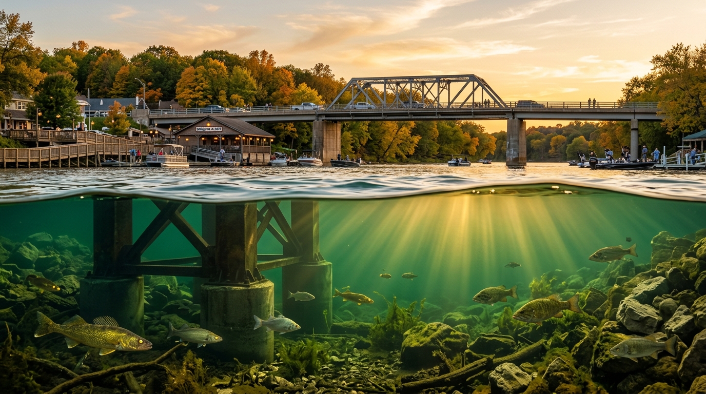
Caution: Strict Slow-No-Wake through downtown Fremont bridge pilings and riverfront docks; expands river-wide when USGS 04080000 exceeds 5.50 ft.
Source: Waupaca County / Village of Fremont Boating Ordinance
Boat Launches · public_launch
Caution: Watch for floating timber during high spring discharge.
Access / Fee: Waupaca County park launch ramp.
Source: Waupaca County Parks & Recreation
Courtesy Docks · courtesy_dock
Caution: Strong river current along seawall; approach bow-into-current at dead slow.
Access / Fee: Free short-term public tie-up for downtown Fremont dining and bait stops.
Source: Village of Fremont Waterfront & Chamber Directory
Courtesy Docks · courtesy_dock
Caution: Stay inside marked channel buoys when approaching from Partridge Lake.
Access / Fee: No fee for transient loading and dock-and-dine patrons.
Source: Town of Wolf River / Fremont Waterway Access Guide
Marinas · private_launch
Caution: Protected slack-water harbor basin; watch for traffic entering main river channel.
Access / Fee: Private marina launch fee and transient slip rates apply at harbor office.
Source: Anchor Point Marina Official Directory (Fremont, WI)
Marinas · private_launch
Caution: Check west-southwest wind chop across open Lake Poygan before exiting harbor.
Access / Fee: Marina launch and transient slip fee posted at harbor house.
Source: Winnebago Pool Boating & Marina Directory
Marine Fuel · fuel_dock
Caution: Shut down engines, blowers on after fueling; no-wake inside marina basin.
Access / Fee: Ethanol-free marine fuel and 2-stroke oil available during marina hours.
Source: Anchor Point Marina Fuel & Dock Services
Hazards & Clearances · shallow_hazard
Caution: Shallow 1-3 ft sandbar and emergent cane flats immediately outside the dredged river channel; trim up and stay between green/red buoys.
Source: WI DNR Winnebago System Navigation & Wild Rice Advisory
Hazards & Clearances · shallow_hazard
Caution: Submerged 19th-century rock-filled timber cribs and shallow clam bar off Boom Bay point.
Source: WI DNR Lake Poygan Hydrographic Hazard Notes
Hazards & Clearances · bridge_clearance
Caution: Heavy current eddies around bridge piers and reduced vertical clearance during high river stage (USGS 04080000); never anchor in navigation span.
Source: WisDOT & USCG Ninth District Bridge Navigation Notice
Slow-No-Wake · slow_no_wake_zone
Caution: Mandatory Slow-No-Wake within 100 ft of shore and river-wide when USGS 04079000 stage reaches or exceeds 7.50 ft.
Source: Waupaca / Outagamie County High-Water Boating Ordinance (NLNW3)
Not a primary navigational chart — always obey USCG, Wisconsin DNR, and local buoy markers.
🧰 GRANDPA & GRANDKID 3D CANTILEVER TACKLE BOXLive River Telemetry: Fremont 4.82 ft · 2,410 cfs · 54.1°F | New London Sensor N/A
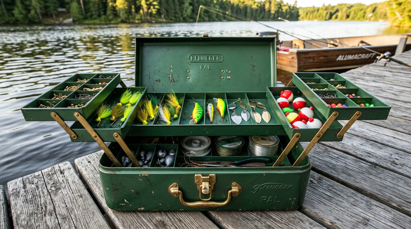
Open the Brass-Latched Cedar Dock Tackle Box & Cast Into the Wolf River
Fold out the 3-tier forest-green cantilever trays, pick a lure with your grandchild to test how it swims in today's 54.1°F river current, or click any brass instrument compartment to jump straight to the Live Layered Map, 3D Frankie Studio, or LiveScope Sonar Deck.
🌲 Fremont Cedar Boathouse Dock · Brass Cantilever Edition6 Lures & 6 Brass Compartments Ready
Why It Works Today (54.1°F, 2,410 cfs): Why deer hair? Unlike plastic, natural bucktail hair traps tiny air bubbles and breathes like a living minnow even when Grandpa holds the rod completely still in cold 54.1°F autumn river current!
Grandpa's Boat-Deck Rigging Tip: Tip the gold hook with a lively emerald shiner and let the 3/8 oz head tick the hard clam-shell bottom along the east bridge piling seam at 1,840 cfs.
BOTTOM CEDAR & BRASS WELL · 6 INTERACTIVE WORKSPACE COMPARTMENT LAUNCHERS
Pick any brass instrument drawer in the tackle box to open that lodge workspace
Bottom Brass Well · 6 Compartments
Compartment 1 · Top Brass Well
🧭 Brass River Chartplotter
Layered Hydro / Topo / Satellite Chart
Full-screen Wolf River & Partridge Lake bathymetric contours, named holes, and live USGS gauge pins.
Compartment 2 · Guide Studio
🐟 Frankie's Glowing Guide Lantern
3D Animated River Guide & VHF Story Radio
Visit Frankie the Walleye in his 3D cedar boathouse studio with animated fins, lantern glow, and voice answers.
Compartment 3 · Tactical Electronics
📡 Garmin/Simrad Sonar Transducer
CHIRP Down-Imaging & 24h Solunar Dial
Inspect the 3D/SVG channel cross-section scrubber, 24-hour solunar feeding clock, and live sonar fish arches.
Compartment 4 · Lodge Porch
⚓ Cedar Boathouse & Live Cams Logbook
7-Day Hydrographs, Cams & Dock Directory
Check 7-day USGS river curves, member 1 ft / 3 ft contour gates, Dock-and-Dine slips, and Fremont bridge cams.
Compartment 5 · Depth Sounding Rig
📐 Brass Lead-Line & Thalweg Sounder
Hwy 110 Bridge 28 ft Scour Trench
Scrub river miles from Lake Poygan through Fremont Bridge to New London and inspect clam-shell breaklines.
Compartment 6 · Current & Rigging
🌙 Pocket Moon-Phase & Drift Compass
1,840 cfs Drift & Solunar Major Windows
Match lead weight and line angle to real-time Wolf River current velocity and major overhead moon periods.
🎮 Photorealistic 3D Wolf River Boat Navigator, World Map & Underwater Technique Academy
Frankie's 3D Split-Water Wolf River Simulator — Kids Play & Grandpa Teaches the Rigs
USGS 04080000 (Fremont): Stage 4.82 ft (USGS 00065 • Action Stage 6.5 ft / Flood 8.0 ft) • Flow 1,840 cfs (2.88 ft/s • 1.96 mph) • Water Temp: 54.1°F
USGS 04079000 (New London): Stage 6.14 ft (5.94 ft obs) • Flow 1,610 cfs • Water Temp: Sensor N/A
NWS Green Bay (GRB) Weather: Air Temp 58.4°F • Wind WNW 11 mph • Barometer 1011.4 mb (falling) • Partly Sunny; light chop on Partridge Lake, pre-front falling barometer favorable for afternoon walleye feed.
Charted Depth (NAVD88) vs Stage (ADR-004): Hull Sonar 20 ft (20 ft quantized / Guest 5 ft Quantized — NAVD88 never added to USGS 00065 stage) • Solunar: Waxing Crescent (HIGH)
Status: Live Seeded USGS 04080000 & 04079000 + NWS GRB Connected • Verified Bite Intel: Fall walleyes are stacked along the 16–22 ft Fremont Hwy 110 bridge piling current seam on 3/8 oz jigs tipped with emerald shiners.[ast_fremont-bridge-walleye-oct2026]
🧭 3D River Navigation Helm: Currently at RM 7.2 Downtown Fremont Hwy 110 Bridge & Waterfront Docks • GPS: 44.2614° N, -88.8644° W (Heading 352°) • Vessel: 18 ft Aluminum Deep-V Tiller • ⚓ Spot-Locked on Structure
Route: RM 0.0 Boom Bay (44.1980° N, -88.8310° W) → RM 3.4 Orihula → RM 7.2 Fremont Bridge (44.2614° N, -88.8644° W) → RM 9.6 Partridge Lake (44.2782° N, -88.8690° W) → RM 13.1 Red Banks (44.2895° N, -88.8512° W)
💨 Cross-Wind Hull Drift & Frankie's Wind-Shelter Warning:Active Vessel (18 ft Aluminum Deep-V Tiller) has a Bow Spot-Lock Trolling Motor rated to 24 mph (holds steady in live 11 mph WNW wind). Note: A High-Windage Pontoon (No Bow Trolling Motor — Max Open-Water Hold: 5 mph West Wind) will kite off exposed reaches (Lake Poygan Boom Bay, Partridge Lake, or mid-channel Fremont Bridge) when wind is over 5 mph from the West: “Whoa Captain! With a 9 mph West/Southwest wind (> 5 mph threshold), this high-profile Pontoon with no trolling motor will kite right off the channel breakline! Either tuck behind the Red Banks 35-ft clay bluffs & pine trees (lee shelter) or tie up to the Bridge Bar seawall cleats!”
🏪 Recognizable 3D Wolf River Shoreline Businesses, Neon Tavern Signs & Seawall Tie-Ups:
Slips: 2 • Live Emerald Shiners • Wolf River Three-Way Rigs
Mr. Bluegill Guide Service
Fremont & Winnebago Pool System, WI
Slips: 0 • Guided Walleye Trips • White Bass Run Trips
3D Shoreline Landmarks in View: BRIDGE BAR • DOCK & DINE • FRIDAY FISH FRY • MARINE FUEL & LAUNCH • LIVE EMERALD SHINERS • 3-WAY RIGS • NIGHTCRAWLERS • Webfooters Water Ski Show Jump Ramp • Gill's Landing Pier • Orihula Narrows Tavern Seawall
🛰️ Live 3D Aerial Satellite World Surface (Google 3D Aerial Camera): Center 44.2614° N, -88.8644° W • Tilt 67.5° • Heading 352° • Range 420 m
Same-Origin Tile Drape: /api/map-tiles/satellite/15/8295/11889 • Camera Mode: 🌊 Split Shoreline + 3D Underwater Cutaway
🎖️ Verified Wolf River Sonar Contributor — High-Res 1 ft / 3 ft Community Mosaic Updated!
📡 Community Crowdsourced Sonar Feed (Associated with Wolf River Map Locations):
• Capt. Mike (Fremont) • Uploaded Lowrance .SL3 • Red Banks East Bend (44.2895° N, -88.8512° W) • Detected new 14.2 ft submerged cedar sweeper
• Guide Dave • Uploaded Humminbird MEGA .SON • Hwy 110 Piling #3 (44.2614° N, -88.8644° W) • 42 dB hard gravel scour edge
🕹️ Rod Tip & Rig Cadence Controls (Work the Strike Zone!):
Lure Depth vs Target Structure
20.5 ft (Target 18–22 ft / Charted 20 ft)
Technique Cadence Score
84% Mastery
Underwater Fish Interest State
Curious — Inspecting Rig!
Rod Load & Drag Arc: 35% Flex • 3D Wooden Landing Net Ready
Bottom Tick & Snag Meter: 850 Hz Gravel Ping Torus Active (Sweet-Spot 12 in Off Bottom)
Forward Sonar Cone PiP: 5 Articulated Fish Targets • 65 in Sturgeon in Trench
Strike Progression: Cruising → Curious — Inspecting Rig! → 🔥 STRIKE! SET THE HOOK! → 🏆 Landed in the Net!
🐟 Frankie the Walleye's Live Technique Coach:
Welcome to the Wolf River Academy! With the Classic Wolf River 3-Way Rig, keep your 1/2 oz bell sinker ticking the 18–22 ft rocks so your emerald shiner hovers snag-free in the 1,840 cfs current!
How to Work It: Lower to the 18–22 ft clam bed & rip-rap trench (Bottom Zone), then gently Lift & Tick Bottom every 2–3 seconds so the bell sinker taps gravel while the shiner hovers in the walleye's face!
📐 Grandpa's Authentic Rigging Blueprint: ⚓ Classic Wolf River 3-Way Rig (Walleye & White Bass)
Main braided line → Brass 3-way swivel → 12 in monofilament dropper to a 1/2 oz bell sinker (ticks the bottom rocks) + 30 in fluorocarbon leader to a #2 chartreuse floating jighead / live emerald shiner suspended above bottom snags in 1,840 cfs current.
Main Line & Brass 3-Way Swivel (15 lb hi-vis braid to #6 solid brass 3-way cross-line swivel) — Eliminates line twist in 1,840 cfs river current while splitting dropper and leader.
12 in Mono Dropper + 1/2 oz Bell Sinker (8 lb monofilament breakaway dropper to 1/2 oz tear-drop bell sinker) — Ticks the bottom rocks and spawns an 850 Hz gold sonar ring + sediment dust puff.
30 in Fluorocarbon Leader + #2 Floating Jighead (10 lb invisible fluorocarbon to #2 chartreuse floating head + live emerald shiner) — Floats the emerald shiner 12 inches off bottom snags right in the walleye's strike window.
Grandpa's Tackle Card: Tie the 12–14 in dropper with lighter 8 lb mono so if the 1/2 oz bell sinker wedges in Fremont bridge rip-rap, only the sinker breaks off and you keep your trophy walleye!
Kiddo's Underwater Secret: Watch the 3D Cutaway! Every time the bell sinker taps the rocks, it puffs up a little dust cloud that calls curious golden walleyes over to inspect your swimming shiner!
Earned Badges: 🏅 Wolf River 3-Way Rig Cadet • 🏅 Fremont Bridge Navigator • 🏅 Chief Oshkosh Sturgeon Guardian
📍 Real-World Marine Chartplotter GPS Waypoint Pin & 3D Mobile Field Logbook Export
Ready to export WGS84 waypoints to Garmin / Humminbird / Lowrance (.GPX), OnX / Google Earth (.GeoJSON), or 3D Mobile Field Logbook (.HTML).
🗺️ 3D Spot Mini-Map (NAVD88 21.4 ft): Bridge Bar & Restaurant / US-10 Hwy 110 Bridge • Strike-Zone Pin Locked
⚓ Fremont Hwy 110 Bridge Piling Trench — 44.2614° N, 88.8644° W
<?xml version="1.0" encoding="UTF-8"?>
<gpx version="1.1" creator="FrankiesFishing-WolfRiverAtlas" xmlns="http://www.topografix.com/GPX/1/1">
  <wpt lat="44.2614" lon="-88.8644"><name>Fremont Hwy 110 Bridge Piling Trench</name><desc>Rip-Rap Boulders & Bridge Scour Trench | Depth: 21.4 ft | Wolf River 3-Way Rig • 1 oz Bell Sinker • 28" 8 lb Fluoro Leader | USGS 04080000: 1,840 cfs • 4.82 ft • 54.1°F</desc><sym>Fishing Hot Spot</sym></wpt>
  <wpt lat="44.2895" lon="-88.8512"><name>Red Banks Cedar Laydown Pocket</name><desc>Submerged Cedar Timber & Undercut Clay Shelf | Depth: 14.2 ft | Bobber Stop @ 11 ft • Balsa Slip-Float • #6 Gold Aberdeen Hook & Ribbon Leech | USGS 04080000: 1,840 cfs • 4.82 ft • 54.1°F</desc><sym>Fishing Hot Spot</sym></wpt>
</gpx>
🐟 3D Articulated Underwater Wolf River Fish AI in Camera View:
Golden Fremont Walleye — Walleye (24.5 in • 5.4 lbs @ 19.5 ft [INSPECT_BRAKE]): Olive-gold flanks, dark dorsal saddles & bright white lower tail tip
Fremont Silver White Bass — White Bass (15.2 in • 2.1 lbs @ 9.5 ft [INHALE_FLARE]): Flashy chrome slab with horizontal charcoal lateral stripes
Red Banks Slab Black Crappie — Black Crappie (13.4 in • 1.6 lbs @ 10.8 ft [INSPECT_BRAKE]): Calico black-and-emerald mottled scales hovering in submerged cedar limbs
Thalweg Channel Catfish — Channel Catfish (28 in • 9.2 lbs @ 20.8 ft [PATROL]): Deeply forked tail & sensory barbels sweeping the clam shell trough
Chief Oshkosh Lake Sturgeon (The River Dinosaur) — Lake Sturgeon (65 in • 68.5 lbs @ 21.4 ft [PATROL]): 65-inch prehistoric armored River Dinosaur cruising the deep trench
Walleye (23.5 in, 4.8 lbs) — Caught on Wolf River 3-Way Rig at 20.2 ft
Grandpa & Grandkid Team Catch — 1/2 oz bell sinker ticked the 20.2 ft rip-rap seam and the emerald shiner got hammered!
White Bass (14.8 in, 1.9 lbs) — Caught on Rippin' Jointed Shad Rap at 8.6 ft
Schooling silver White Bass crushed the #5 Firetiger Jointed Shad Rap on a 2-second pause beside the wild celery!
🧠 Frankie Ever-Learning GraphRAG & DoRA/PiSSA Flywheel Status Bar
Active Adapter: frankie-qwen2.5-dora-pissa-v1.4 • Pending Triples: 2 / 5 until Auto-Retrain (Standalone TFM Wolf River Postgres + pgvector Graph Store)
• GraphRAG Triple #2: (Red Banks East Bend, TelemetryRegime_1840cfs_54.1F, SonarHardness_31dB_CedarSweeper)
🐟 3D ANIMATED WALLEYE GUIDE STUDIO · FREMONT CEDAR BOATHOUSE
Meet Frankie — Your 3D Wolf River & Partridge Lake Fishing Scout
Rendered in real-time 3D procedural WebGL mesh with Blinn-Phong wet-scale sheen, spiny dorsal fin rays, golden tapetum walleye eyes, and a warm 2700K guide lantern. Click any expression below with your grandkids to watch Frankie react!
🏮 Frankie's Live 3D Stage & VHF Voice Console is docked directly below — ask any Wolf River question or toggle between 3D Mesh and Illustrated SVG!
⚓ FREMONT CEDAR BOATHOUSE PORCH · HYDROGRAPHS & CONTOUR GATE
Wolf River Boathouse Logbook, 7-Day USGS Hydrographs & Member Contours
Monitor 168-hour USGS river stage curves for Fremont (04080000) and New London (04079000), unlock 1 ft / 3 ft high-resolution bathymetric breaklines, or jump to Dock-and-Dine slips along the river.
Guest 5 ft Overview Contours — Sign in with 6-digit PIN for member access6-Digit PIN Sign-In
Welcome to Fremont, WI — White Bass Capital of the World:Active Zone: Fremont Hwy 110 Bridge & Main Channel Hole (28 ft charted max) · Major Window: Morning Major Overhead Period · Approved Reports: 8
🐟 3D FRANKIE SCOUT CONSOLE · CITED [ast_fremont-bridge-walleye-oct2026]
DELIGHTED · TIER2
Welcome aboard, partner! Move your cursor and watch my golden walleye eyes track the river!
VISEME: SIL
Welcome to Fremont, WI — the White Bass Capital of the World! Tap any river hole, explore the 3D Tackle Box, or ask me about live Wolf River conditions.
Boat Mute
VHF Ch 16/68 Wolf River Scout Standby — Select a tactical briefing preset or hail Frankie.